

Support truly
independent journalism
Our mission is to deliver unbiased, fact-based reporting that holds power to account and exposes the truth.
Whether $5 or $50, every contribution counts.
Support us to deliver journalism without an agenda.

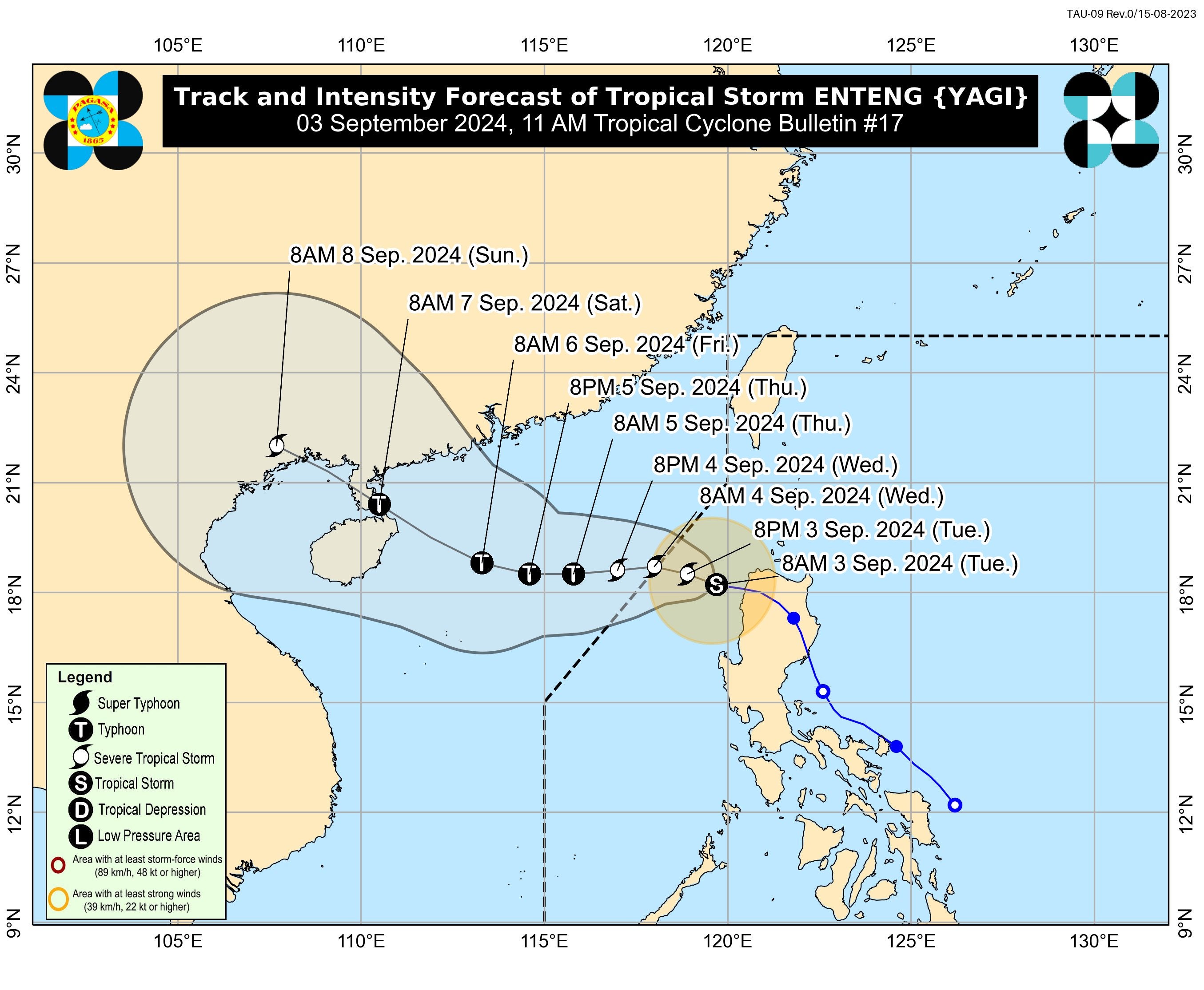
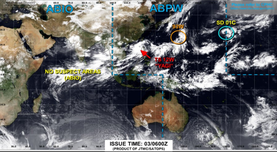
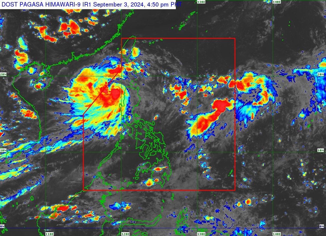
Tropical Storm Yagi is steadily intensifying as it moves northwest across the South China Sea, after leaving a trail of devastation in the Philippines.
The severe tropical storm intensified further on Wednesday, reaching maximum sustained winds of 100kmph and gusts reaching up to 125kmph.
It turned into a severe tropical storm on Tuesday and is expected to further intensify into a typhoon as it approaches southern China’s Hainan Island later this week.
Despite the storm’s exit from the Philippines, heavy rainfall – up to 100mm – was still forecasted to lash parts of Luzon in the north.
The storm has already claimed at least 14 lives in the Philippines, causing heavy rainfall and landslides before moving towards the west.
The impending arrival of Yagi has triggered alerts in southern China, where heavy rainfall, strong winds, and rough seas are anticipated.
Authorities in Hong Kong are preparing for the storm, with warnings of deteriorating weather conditions, including squally showers and swells, over the next few days. The city, known for its robust typhoon preparedness, is bracing for potentially severe impacts as Yagi draws nearer.
Hong Kong’s Observatory has issued level one typhoon warning and indicated there was a “relatively high” chance of this being upgraded to level three – in a five-point scale – on Wednesday, according to SCMP.
The forecaster’s storm tracker shows Yagi passing within 400km of Hong Kong on Thursday, with further intensification into a severe typhoon expected by Friday.
In the Philippines, where the storm is locally known as Enteng, the damage has been severe. Landslides, floods, and strong winds have caused widespread destruction, particularly in the northern regions.
In the tourist city of Antipolo a landslide killed three people, including a pregnant woman, while floodwaters claimed the lives of four others. The storm has also caused extensive disruption to transportation, with flights cancelled and sea travel suspended, leaving thousands stranded.
Read more about the storm’s impact on the Philippines here.
Even as the storm passed through into the sea, the Philippine Atmospheric Geophysical Astronomical Services Administration (PAGASA) continued to issue warnings on Tuesday, predicting more heavy rainfall and possible landslides in the northern and central regions in the coming days. The capital, Manila, remains on high alert, with schools suspended and government offices closed.